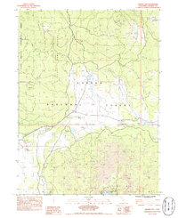
1983 Map of Harvey Mountain
USGS Topo · Published 1985About this map
Blacks Mountain Experimental Forest and the Lassen National Forest define this high-altitude terrain in the early 1980s. The landscape is a complex mix of timber management, water resources, and volcanic geology, evidenced by the broad fields of Lava in the southern sections. Notable water features include White Horse Reservoir and Shoestring Reservoir, while land use is marked by a network of wells and springs like Rock Cabin Well and Dixie Spring. The transit of the area reflects its industrial and resource-based history, with an Old Railroad Grade winding through Burgess Meadow and the presence of Harvey Station. High points like Patterson Mtn and Harvey Mtn anchor the topography, which includes specialized areas like the State Game Refuge and the Crater Lake Campground. This map provides a detailed view of the infrastructure supporting forestry and land management, from the Cone Two Water Tank to numerous borrow pits.
Find a feature on this map
42 named features on this map. Tap any name to fly to it.
Don’t see what you’re looking for? This feature index may not catch every label — zoom into the map to look around manually.
Map Details
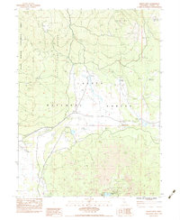
Editions of this 1983 Harvey Mountain Map
2 editions found
Other maps of this area

1886 · Honey Lake
USGS Topo · 1:250,000

1886 · Lassen Peak
USGS Topo · 1:250,000

1891 · Honey Lake
USGS Topo · 1:250,000

1892 · Lassen Peak
USGS Topo · 1:250,000

1893 · Honey Lake
USGS Topo · 1:250,000

1894 · Lassen Peak
USGS Topo · 1:250,000

1939 · Halls Flat
USGS Topo · 1:125,000

1955 · Westwood
USGS Topo · 1:250,000

1956 · Hayden Hill
USGS Topo · 1:62,500

1956 · Harvey Mtn
USGS Topo · 1:62,500