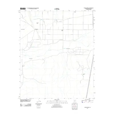
2011 Map of Hassayampa
USGS Topo · Published 2011About this map
Palo Verde and Hassayampa anchor this Maricopa County landscape, situated at a critical juncture where the Hassayampa River meets the Buckeye Valley. The settlement pattern here is defined by a dense grid of rural roads and irrigation corridors, reflecting the area's agricultural development south of the Conger area. The transition from the flat, irrigated fields to the surrounding desert topography is clearly visible, showing how local water management has shaped the human footprint in this part of the Sonoran Desert. For those interested in Arizona's rural growth, the map detail provides a clear look at the intersection of natural drainage and modern infrastructure in the early 21st century.
Find a feature on this map
4 named features on this map. Tap any name to fly to it.
Don’t see what you’re looking for? This feature index may not catch every label — zoom into the map to look around manually.
Map Details
Editions of this 2011 Hassayampa Map
This is the sole edition of this map. No revisions or reprints were ever made.
Other maps of this area

1951 · Cotton Center
USGS Topo · 1:62,500

1951 · Woolsey Peak
USGS Topo · 1:62,500

1954 · Phoenix
USGS Topo · 1:250,000

1957 · Phoenix
USGS Topo · 1:250,000

1957 · Valencia
USGS Topo · 1:24,000

1958 · Phoenix
USGS Topo · 1:250,000

1958 · Buckeye NW
USGS Topo · 1:24,000

1958 · Hassayampa
USGS Topo · 1:24,000

1958 · Buckeye
USGS Topo · 1:24,000

1958 · Buckeye
USGS Topo · 1:62,500