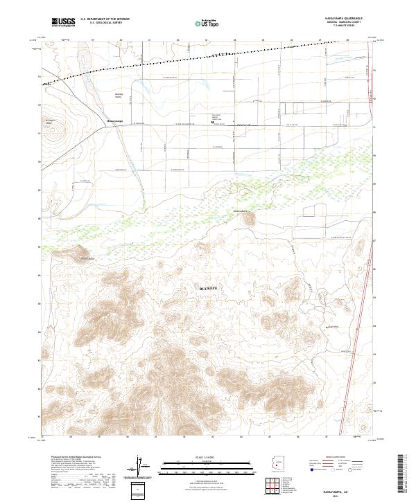
2021 Map of Hassayampa
USGS Topo · Published 2021About this map
Hassayampa River and the Gila River converge in this western portion of the Salt River Valley, defining a landscape of irrigated agriculture and desert ranges. The map shows the intricate network of the Buckeye Canal and Arlington Canal, which have supported the farming settlements of Hassayampa, Palo Verde, and Dixie for over a century. Local history and genealogy are centered around the Palo Verde Baptist Church and the adjacent Palo Verde Baptist Church Cem, standing as long-established landmarks amidst the fields of Buckeye Valley. The terrain shifts abruptly from the flat irrigated bottomlands to the prominent volcanic profiles of Robbins Butte and Powers Butte, while the southern portion is dominated by the steep, rising slopes of the Buckeye Hills. This contemporary survey reflects the enduring importance of historical routes like Old US Hwy 80 in connecting these rural Maricopa County communities.
Find a feature on this map
49 named features on this map. Tap any name to fly to it.
Don’t see what you’re looking for? This feature index may not catch every label — zoom into the map to look around manually.
Map Details
Editions of this 2021 Hassayampa Map
This is the sole edition of this map. No revisions or reprints were ever made.
Other maps of this area

1951 · Cotton Center
USGS Topo · 1:62,500

1951 · Woolsey Peak
USGS Topo · 1:62,500

1954 · Phoenix
USGS Topo · 1:250,000

1957 · Phoenix
USGS Topo · 1:250,000

1957 · Valencia
USGS Topo · 1:24,000

1958 · Phoenix
USGS Topo · 1:250,000

1958 · Buckeye NW
USGS Topo · 1:24,000

1958 · Hassayampa
USGS Topo · 1:24,000

1958 · Buckeye
USGS Topo · 1:24,000

1958 · Buckeye
USGS Topo · 1:62,500