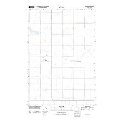
2011 Map of Hastings
USGS Topo · Published 2011About this map
Hastings serves as the primary settlement hub in this 2011 survey of Barnes County, where the street grid of Main St, Oak Ave, and Spruce St centers the local community. The landscape is defined by the winding paths of Spring Creek and Bear Creek, highlighting the importance of water management in this agricultural region. Evidence of early settlement and regional genealogy is found at the Spring Creek Cemetery, while the presence of the Clausen Springs Dam indicates more modern hydrological developments along the creek. The map reflects a highly organized township structure, with a dense network of section-line roads such as 113th Ave SE and 50th St SE creating a regular patchwork across the North Dakota prairie.
Find a feature on this map
22 named features on this map. Tap any name to fly to it.
Don’t see what you’re looking for? This feature index may not catch every label — zoom into the map to look around manually.
Map Details
Editions of this 2011 Hastings Map
This is the sole edition of this map. No revisions or reprints were ever made.
Other maps of this area

1897 · Tower
USGS Topo · 1:125,000

1897 · Eckelson
USGS Topo · 1:125,000

1953 · Jamestown
USGS Topo · 1:250,000

1953 · Fargo
USGS Topo · 1:250,000

1956 · Fargo
USGS Topo · 1:250,000

1956 · Jamestown
USGS Topo · 1:250,000

1967 · Ft. Ransom
USGS Topo · 1:24,000

1967 · Fingal SW
USGS Topo · 1:24,000
1967 · Kathryn
USGS Topo · 1:24,000

1970 · Litchville
USGS Topo · 1:24,000