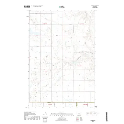
2018 Map of Hastings
USGS Topo · Published 2018About this map
Hastings serves as the central point of interest in this survey of Skandia Township, where the small community is situated at the intersection of Main St and 50th St SE. The landscape is defined by the winding paths of Spring Creek and Bear Creek, which traverse a terrain marked by numerous small wetlands and prairie potholes. Just north of the settlement, the Spring Creek Cem stands as a significant site for genealogical research, documenting the local families of this Barnes County region. For modern recreation and natural study, the N Country National Scenic Trail cuts through the eastern portion of the map, following the contours of the drainage basin. This 2018 edition provides a clear view of the rural section-line road network, including 46th St SE through 54th St SE, as they intersect at the border where Barnes, LaMoure, and Ransom counties meet.
Find a feature on this map
24 named features on this map. Tap any name to fly to it.
Don’t see what you’re looking for? This feature index may not catch every label — zoom into the map to look around manually.
Map Details
Editions of this 2018 Hastings Map
This is the sole edition of this map. No revisions or reprints were ever made.
Other maps of this area

1897 · Tower
USGS Topo · 1:125,000

1897 · Eckelson
USGS Topo · 1:125,000

1953 · Jamestown
USGS Topo · 1:250,000

1953 · Fargo
USGS Topo · 1:250,000

1956 · Fargo
USGS Topo · 1:250,000

1956 · Jamestown
USGS Topo · 1:250,000

1967 · Ft. Ransom
USGS Topo · 1:24,000

1967 · Fingal SW
USGS Topo · 1:24,000
1967 · Kathryn
USGS Topo · 1:24,000

1970 · Litchville
USGS Topo · 1:24,000