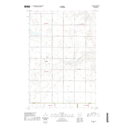
2020 Map of Hastings
USGS Topo · Published 2020About this map
The small settlement of Hastings serves as the focal point of this Barnes County landscape, situated where the local road network, including Main St, meets the surrounding prairie. This 2020 study reveals a region defined by its traditional agricultural grid and several important local landmarks. Two historic burial grounds, Sunnyside Cem and Spring Creek Cem, are located north and west of the town center, respectively. The modern inclusion of the N Country National Scenic Trail winds through the eastern sections, crossing the drainages of Spring Creek and adding a recreational layer to the historical rural fabric. In the southern reaches of the map, the headwaters and tributaries of Bear Creek flow near the border of Lamoure and Ransom counties, reflecting the subtle drainage patterns that have shaped local farmsteads for generations.
Find a feature on this map
27 named features on this map. Tap any name to fly to it.
Don’t see what you’re looking for? This feature index may not catch every label — zoom into the map to look around manually.
Map Details
Editions of this 2020 Hastings Map
This is the sole edition of this map. No revisions or reprints were ever made.
Other maps of this area

1897 · Tower
USGS Topo · 1:125,000

1897 · Eckelson
USGS Topo · 1:125,000

1953 · Jamestown
USGS Topo · 1:250,000

1953 · Fargo
USGS Topo · 1:250,000

1956 · Fargo
USGS Topo · 1:250,000

1956 · Jamestown
USGS Topo · 1:250,000

1967 · Ft. Ransom
USGS Topo · 1:24,000

1967 · Fingal SW
USGS Topo · 1:24,000
1967 · Kathryn
USGS Topo · 1:24,000

1970 · Litchville
USGS Topo · 1:24,000