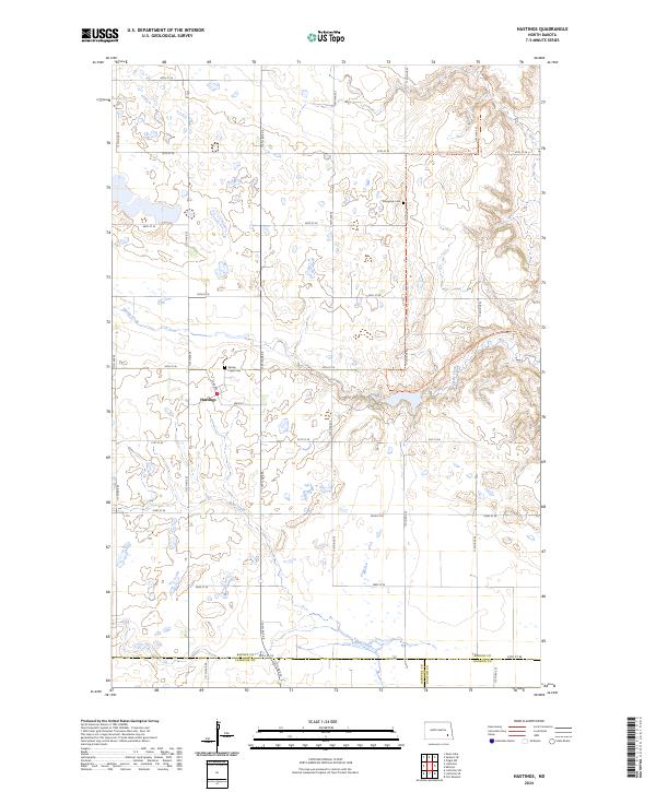
2024 Map of Hastings
USGS Topo · Published 2024About this map
Hastings sits at the heart of this landscape where the undulating prairie meets the winding drainage of Spring Creek. The area is defined by its agricultural grid and significant natural conservation zones, most notably the Barnes County Waterfowl Production Area, which preserves the wetland depressions characteristic of this region. Local heritage is centered around the Spring Creek Cem and Sunnyside Cem, which serve as primary markers of the early families who settled these sections of Barnes County. The modern mapping also highlights the North Country National Scenic Trl as it traverses the higher ground in the northeastern corner. Tracing southward toward the border of LaMoure and Ransom counties, the terrain gradually shifts into the Bear Creek drainage, illustrating the subtle but important hydrological divides of the North Dakota plains.
Find a feature on this map
32 named features on this map. Tap any name to fly to it.
Don’t see what you’re looking for? This feature index may not catch every label — zoom into the map to look around manually.
Map Details
Editions of this 2024 Hastings Map
This is the sole edition of this map. No revisions or reprints were ever made.
Other maps of this area

1897 · Tower
USGS Topo · 1:125,000

1897 · Eckelson
USGS Topo · 1:125,000

1953 · Jamestown
USGS Topo · 1:250,000

1953 · Fargo
USGS Topo · 1:250,000

1956 · Fargo
USGS Topo · 1:250,000

1956 · Jamestown
USGS Topo · 1:250,000

1967 · Ft. Ransom
USGS Topo · 1:24,000

1967 · Fingal SW
USGS Topo · 1:24,000
1967 · Kathryn
USGS Topo · 1:24,000

1970 · Litchville
USGS Topo · 1:24,000
Featured Places
- Nelson Township, ND
- Skandia Township, ND
- Spring Creek Township, ND
- Litchville Township, ND
- Northland Township, ND