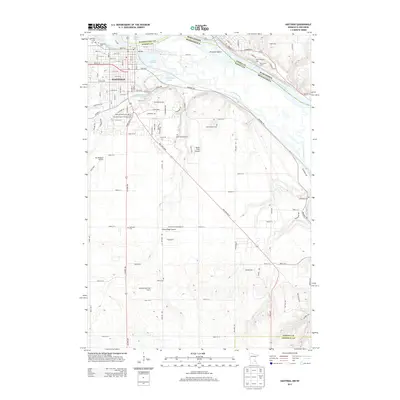
2013 Map of Hastings
USGS Topo · Published 2013About this map
Hastings sits at the confluence of major waterways, where the Mississippi River meets the Vermillion River along the border of Minnesota and Wisconsin. This 2013 survey reveals a landscape deeply connected to its river heritage, featuring Prescott Island and various smaller basins such as Lake Rebecca, Lake Isabelle, and Bull Frog Lake. The area's history is reflected in its numerous burial grounds, ranging from the Veterans Cem and Lakeside Cem in the north to the Ravenna Cem and Marsh Cem in the rural southeast. Aviation infrastructure is prominent across the terrain, with Sandy Flats Airport, Sky Meadow Airport, and Willow Ridge Airport serving the region. The map also delineates the extensive parklands and recreation areas like Greenwood Campground and the Bellwood Oaks Golf Course, showing how the modern community has developed around the natural watercourses and the historic city center.
Find a feature on this map
103 named features on this map. Tap any name to fly to it.
Don’t see what you’re looking for? This feature index may not catch every label — zoom into the map to look around manually.
Map Details
Editions of this 2013 Hastings Map
This is the sole edition of this map. No revisions or reprints were ever made.
Other maps of this area

1944 · Red Wing
USGS Topo · 1:62,500

1946 · Hudson
USGS Topo · 1:62,500

1946 · River Falls
USGS Topo · 1:62,500

1949 · River Falls
USGS Topo · 1:62,500

1949 · Hudson
USGS Topo · 1:62,500

1950 · St Paul Park
USGS Topo · 1:24,000

1951 · St Paul Park
USGS Topo · 1:24,000

1951 · Prescott
USGS Topo · 1:24,000

1952 · Red Wing
USGS Topo · 1:62,500

1953 · Saint Paul
USGS Topo · 1:250,000