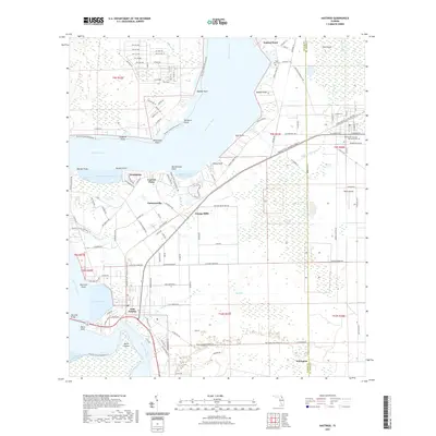
2021 Map of Hastings
USGS Topo · Published 2021About this map
The Saint Johns River defines the western edge of this 2021 landscape, where several distinct points and coves carve into the shoreline from Federal Point down to East Palatka. The terrain transitions from riverfront settlements like Grandview and Patersonville into the interior agricultural and marshy lowlands of Cracker Swamp. Transport corridors are central to the area's layout, including the Palatka-To-St. Augustine State Trl and the Putnam County Blueways Trl, which follow the historical movement patterns between these river towns. Small community hubs such as Orange Mills and Yelvington remain marked by their local infrastructure, including cemeteries like Saint Pauls Cem and the Resthaven Cem and Memorial Park. The southern portion of the sheet is punctuated by the Memorial Bridge and the distinctive bend at Devils Elbow, illustrating the enduring importance of the river for navigation and connection.
Find a feature on this map
46 named features on this map. Tap any name to fly to it.
Don’t see what you’re looking for? This feature index may not catch every label — zoom into the map to look around manually.
Map Details
Editions of this 2021 Hastings Map
This is the sole edition of this map. No revisions or reprints were ever made.
Other maps of this area

1912 · Palatka
USGS Topo · 1:48,000

1915 · Palatka
USGS Topo · 1:62,500

1937 · Elkton
USGS Topo · 1:24,000

1937 · Dinner Island
USGS Topo · 1:48,000

1943 · St. Augustine
USGS Topo · 1:62,500

1943 · Dinner Island
USGS Topo · 1:62,500

1944 · Dinner Island
USGS Topo · 1:62,500

1947 · Bostwick
USGS Topo · 1:50,000

1949 · Bostwick
USGS Topo · 1:24,000
1949 · Riverdale
USGS Topo · 1:24,000