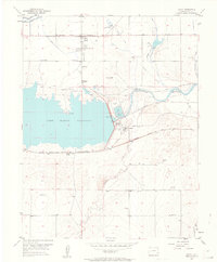
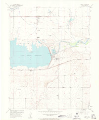
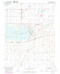
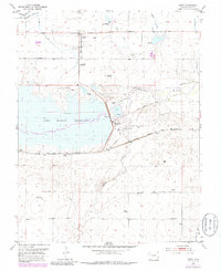
1953 Map of Hasty
USGS Topo · Published 1963About this map
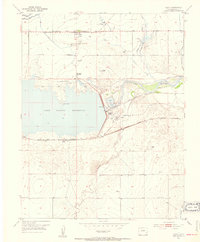
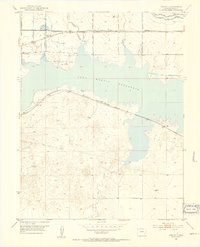
The waters of the John Martin Reservoir dominate this landscape, created by the damming of the Arkansas River in the mid-20th century. Just north of the reservoir, the town of Hasty serves as a focal point for the surrounding plains, while the small settlement of Caddoa and its associated Caddoa (Siding) lie near the shoreline. The map documents a complex irrigation network vital to the High Plains, including the Kicking Bird Canal, Fort Lyon Canal, and the Verhoeff Ditch.
Find a feature on this map
31 named features on this map. Tap any name to fly to it.
Don’t see what you’re looking for? This feature index may not catch every label — zoom into the map to look around manually.
Map Details
Editions of this 1953 Hasty Map
5 editions found
Other maps of this area

1891 · Higbee
USGS Topo · 1:125,000

1891 · Las Animas
USGS Topo · 1:125,000

1892 · Lamar
USGS Topo · 1:125,000

1892 · Two Butte
USGS Topo · 1:125,000

1893 · Higbee
USGS Topo · 1:125,000

1893 · Two Butte
USGS Topo · 1:125,000
1893 · Las Animas
USGS Topo · 1:125,000
1953 · Hasty
USGS Topo · 1:24,000
1953 · Prowers
USGS Topo · 1:24,000
1953 · Kreybill
USGS Topo · 1:24,000