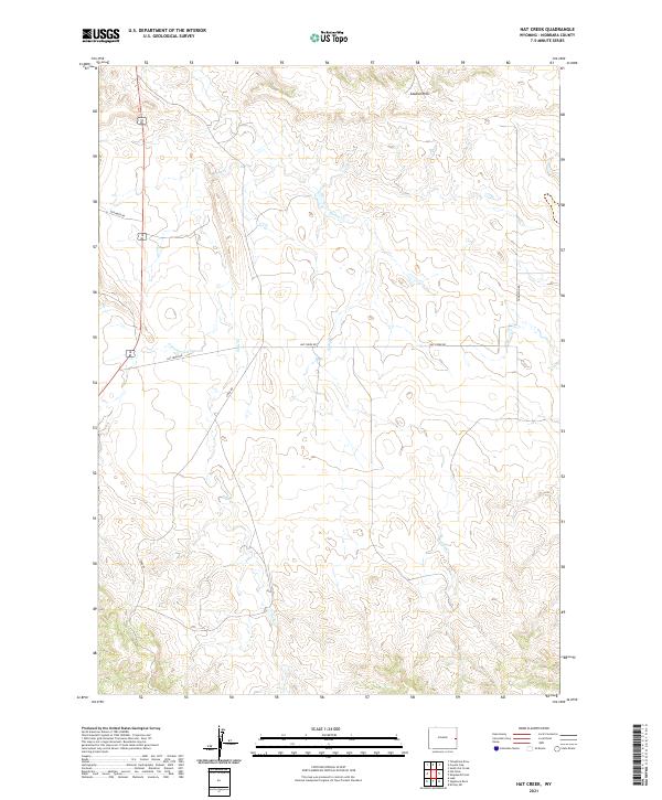
2021 Map of Hat Creek
USGS Topo · Published 2021About this map
Seaman Hills dominate the northern landscape of this Niobrara County territory, where a network of ephemeral watercourses defines the open range of eastern Wyoming. Drainage patterns like Sage Cr, Spring Cr, and Cottonwood Cr wind through the township and range sections, illustrating the typical high-plains topography of the region. The map captures a transition in local infrastructure, anchored by the intersection of several notable rural routes. Local travelers and ranchers navigate the land via Hat Creek Rd and Stage Rd, which follow the natural contours of the drainage basins. This 2021 update preserves the exact layout of land divisions, including Geisinger Rd and Thompson Rd, which provide access to the vast acreage of eastern Wyoming's agricultural and pastoral interior.
Find a feature on this map
12 named features on this map. Tap any name to fly to it.
Don’t see what you’re looking for? This feature index may not catch every label — zoom into the map to look around manually.
Map Details
Editions of this 2021 Hat Creek Map
This is the sole edition of this map. No revisions or reprints were ever made.
Other maps of this area

1954 · Torrington
USGS Topo · 1:250,000

1955 · Newcastle
USGS Topo · 1:250,000

1958 · Torrington
USGS Topo · 1:250,000

1958 · Newcastle
USGS Topo · 1:250,000

1978 · Shepherds Point
USGS Topo · 1:24,000

1978 · Kirtley SW
USGS Topo · 1:24,000
1978 · South Oat Creek
USGS Topo · 1:24,000

1981 · Telephone Draw
USGS Topo · 1:24,000

1981 · Lusk
USGS Topo · 1:24,000
1981 · Signature Rock
USGS Topo · 1:24,000