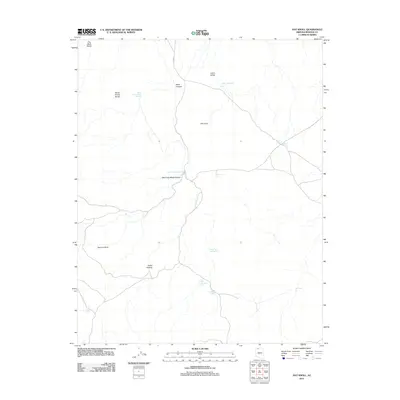
2011 Map of Hat Knoll
USGS Topo · Published 2011About this map
Hat Knoll rises above a landscape defined by seasonal water catchments and drainage systems in this northern Mohave County desert region. The terrain is marked by significant topographical landmarks such as The Black Rocks and the sprawling Seven Knolls Bench, which overlooks several artificial catchments including Seven Knolls Bench Reservoir. These reservoirs and "tanks," such as Cabin Valley Tank and Larimore Tank, reveal the critical infrastructure required for ranching or land management in an arid environment. Transportation through the area is anchored by Co HWY 5, which navigates the corridor near Black Canyon. Small, named geographical pockets like Cutler Pockets and Spencer Knoll provide specific reference points for navigators and historians studying the spatial distribution of resources across the Arizona strip.
Find a feature on this map
19 named features on this map. Tap any name to fly to it.
Don’t see what you’re looking for? This feature index may not catch every label — zoom into the map to look around manually.
Map Details
Editions of this 2011 Hat Knoll Map
This is the sole edition of this map. No revisions or reprints were ever made.
Other maps of this area

1886 · Mt. Trumbull
USGS Topo · 1:250,000

1886 · Kaibab
USGS Topo · 1:250,000

1892 · Mt. Trumbull
USGS Topo · 1:250,000

1953 · Grand Canyon
USGS Topo · 1:250,000

1954 · Heaton Knolls NW
USGS Topo · 1:24,000

1954 · Heaton Knolls
USGS Topo · 1:62,500

1957 · Grand Canyon
USGS Topo · 1:250,000

1958 · Grand Canyon
USGS Topo · 1:250,000

1960 · Grand Canyon
USGS Topo · 1:250,000

1962 · Tuckup Canyon
USGS Topo · 1:62,500