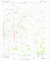
1971 Map of Hat Knoll
USGS Topo · Published 1974About this map
Cutler Pockets serves as a rare focal point in this 1971 survey of the high desert plateau in Mohave County. The landscape is defined by a sophisticated system of water catchment and storage essential for ranching and survival, including the Seven Knolls Bench Reservoir, Black Canyon Reservoir, and numerous specialized basins like Langston Black Canyon Tank and Leslie Tank No 2. These features, alongside the uniquely named The Lake, trace the sparse human attempts to manage the arid environment between the prominent elevation of Hat Knoll and the lowlands of Little Clayhole Valley. A network of Jeep Trails provides the primary means of traversal through the formations of The Black Rocks and along the edges of Antelope Valley, marking the movement of land managers and ranchers across this isolated terrain.
Find a feature on this map
22 named features on this map. Tap any name to fly to it.
Don’t see what you’re looking for? This feature index may not catch every label — zoom into the map to look around manually.
Map Details
Editions of this 1971 Hat Knoll Map
This is the sole edition of this map. No revisions or reprints were ever made.
Other maps of this area

1886 · Mt. Trumbull
USGS Topo · 1:250,000

1886 · Kaibab
USGS Topo · 1:250,000

1892 · Mt. Trumbull
USGS Topo · 1:250,000

1953 · Grand Canyon
USGS Topo · 1:250,000

1954 · Heaton Knolls NW
USGS Topo · 1:24,000

1954 · Heaton Knolls
USGS Topo · 1:62,500

1957 · Grand Canyon
USGS Topo · 1:250,000

1958 · Grand Canyon
USGS Topo · 1:250,000

1960 · Grand Canyon
USGS Topo · 1:250,000

1962 · Tuckup Canyon
USGS Topo · 1:62,500