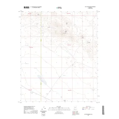
2023 Map of Hat Top Mountain
USGS Topo · Published 2023About this map
Hat Top Mountain and the Cedar Mountain Range dominate this arid landscape along the border of Grant and Luna Counties. This modern survey illustrates a classic high-desert environment defined by drainage systems like Willow Draw and Cedar Grove Draw which cut through the elevated terrain. Water management is the primary sign of human activity across these townships, as evidenced by a sophisticated network of catchment features including CCC Tank, Snake Tank, and Railroad Tank. The presence of the CCC Tank provides a direct connection to early 20th-century conservation work in the American West. At the southern end of the quadrangle, Rock Hole Canyon and The Lake offer significant landmarks for navigators and historians studying the ranching and resource patterns of this New Mexico borderland.
Find a feature on this map
30 named features on this map. Tap any name to fly to it.
Don’t see what you’re looking for? This feature index may not catch every label — zoom into the map to look around manually.
Map Details
Editions of this 2023 Hat Top Mountain Map
This is the sole edition of this map. No revisions or reprints were ever made.
Other maps of this area

1918 · Hachita
USGS Topo · 1:62,500

1918 · Victorio
USGS Topo · 1:62,500

1954 · Silver City
USGS Topo · 1:250,000

1955 · Douglas
USGS Topo · 1:250,000

1958 · Silver City
USGS Topo · 1:250,000

1959 · Douglas
USGS Topo · 1:250,000

1961 · Douglas
USGS Topo · 1:250,000

1962 · Silver City
USGS Topo · 1:250,000

1963 · Gage SW
USGS Topo · 1:24,000
1963 · Gage SE
USGS Topo · 1:24,000