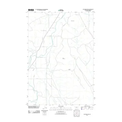
2011 Map of Hatcher Pass
USGS Topo · Published 2011About this map
Clarks Fork Yellowstone River defines the western edge of this landscape in Carbon County, where a complex network of irrigation infrastructure supports the agricultural valley. The presence of numerous engineered waterways, such as Mutual Ditch, Holland Ditch, and Golden Ditch, illustrates the intensive water management required for farming in this Montana corridor. This high-plains terrain is punctuated by significant landmarks like Schwend Hill and Deer Mountain, with Hatcher Pass serving as a notable point between the drainage of Cottonwood Creek and the river valley below.
Find a feature on this map
30 named features on this map. Tap any name to fly to it.
Don’t see what you’re looking for? This feature index may not catch every label — zoom into the map to look around manually.
Map Details
Editions of this 2011 Hatcher Pass Map
This is the sole edition of this map. No revisions or reprints were ever made.
Other maps of this area

1932 · Red Lodge No 1
USGS Topo · 1:48,000

1944 · Red Lodge
USGS Topo · 1:62,500

1954 · Billings
USGS Topo · 1:250,000

1956 · Bridger
USGS Topo · 1:24,000

1956 · The Big Slide
USGS Topo · 1:24,000

1957 · Billings
USGS Topo · 1:250,000

1958 · Billings
USGS Topo · 1:250,000

1967 · Bluewater
USGS Topo · 1:24,000
1969 · Hollenbeck Draw
USGS Topo · 1:24,000
1969 · Hatcher Pass
USGS Topo · 1:24,000