
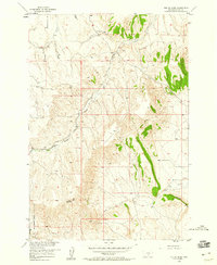
1956 Map of The Big Slide
USGS Topo · Published 1958About this map
The dramatic geological formation of The Big Slide anchors this mid-century survey of the Carbon County landscape. Situated within the Missouri River Basin development program, the area is defined by a dendritic network of drainage systems including Elbow Creek, Sand Creek, and Cherry Creek. While largely focused on the complex topography of the Dry Creek Basin, the map records essential local landmarks of the 1950s rural infrastructure, most notably the Loyning Sch. A significant Pipeline traverses the southern reaches of the quadrangle, signaling the industrial activity present in this part of Montana during the era. The presence of isolated tanks and family-named watercourses like Gramps Creek provides specific points of interest for those researching the historical land use and early school district locations in this region.
Find a feature on this map
16 named features on this map. Tap any name to fly to it.
Don’t see what you’re looking for? This feature index may not catch every label — zoom into the map to look around manually.
Map Details
Editions of this 1956 The Big Slide Map
2 editions found
Other maps of this area

1932 · Red Lodge No 1
USGS Topo · 1:48,000

1944 · Red Lodge
USGS Topo · 1:62,500

1954 · Billings
USGS Topo · 1:250,000

1956 · Bridger
USGS Topo · 1:24,000

1956 · Fromberg
USGS Topo · 1:24,000

1956 · Roberts
USGS Topo · 1:24,000
1956 · Boyd
USGS Topo · 1:24,000
1956 · Cooney Reservoir
USGS Topo · 1:24,000

1957 · Billings
USGS Topo · 1:250,000

1958 · Billings
USGS Topo · 1:250,000