
1956 Map of Fromberg
USGS Topo · Published 1958About this map
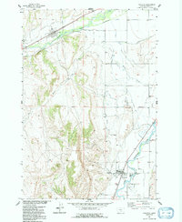
The confluence of Clarks Fork Yellowstone River and Rock Creek defines the local economy and geography of this Carbon County landscape in the mid-1950s. The settlement of Fromberg sits along the river's western bank, protected by the Levee, while the town of Joliet is situated to the northwest at the foot of the hills. An intricate network of irrigation projects, including the Carbon Canal, First Chance Ditch, and Dutton Canal, crisscrosses the valley floor, highlighting the region's intensive agricultural development.
Find a feature on this map
30 named features on this map. Tap any name to fly to it.
Don’t see what you’re looking for? This feature index may not catch every label — zoom into the map to look around manually.
Map Details
Editions of this 1956 Fromberg Map
2 editions found
Other maps of this area

1892 · Stillwater
USGS Topo · 1:125,000

1932 · Red Lodge No 1
USGS Topo · 1:48,000

1954 · Billings
USGS Topo · 1:250,000

1956 · Bridger
USGS Topo · 1:24,000

1956 · Silesia
USGS Topo · 1:24,000

1956 · Rapids
USGS Topo · 1:24,000
1956 · Boyd
USGS Topo · 1:24,000

1956 · Edgar
USGS Topo · 1:24,000

1956 · The Big Slide
USGS Topo · 1:24,000
1956 · Montaqua
USGS Topo · 1:24,000