
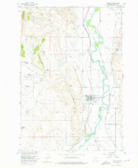
1956 Map of Bridger
USGS Topo · Published 1957About this map
Clarks Fork Yellowstone River dominates this mid-century landscape, flanked by an intricate network of irrigation channels including the Orchard Canal and Bartlett Ditch. The town of Bridger serves as a central hub, where the Northern Pacific and Chicago Burlington and Quincy Railroad meet. The map reveals a community deeply tied to both transit and agriculture, evidenced by the numerous named properties like Phillips Ranch and Langstaff Ranch dotting the terrain west of the river. Local infrastructure is well-defined, from the Bridger Cem and the Bostic Cem to a local Drive-in Theater and Rodeo Ground. To the northwest, the Cherry Springs Sch (Aband) reflects shifts in rural education. The presence of several Gravel Pit sites and a Mine Dump suggests a diversified local economy beyond the river-fed fields and livestock operations.
Find a feature on this map
36 named features on this map. Tap any name to fly to it.
Don’t see what you’re looking for? This feature index may not catch every label — zoom into the map to look around manually.
Map Details
Editions of this 1956 Bridger Map
2 editions found
Other maps of this area

1932 · Red Lodge No 1
USGS Topo · 1:48,000

1944 · Red Lodge
USGS Topo · 1:62,500

1954 · Billings
USGS Topo · 1:250,000

1956 · Fromberg
USGS Topo · 1:24,000
1956 · Boyd
USGS Topo · 1:24,000

1956 · Edgar
USGS Topo · 1:24,000

1956 · The Big Slide
USGS Topo · 1:24,000

1957 · Billings
USGS Topo · 1:250,000

1958 · Billings
USGS Topo · 1:250,000

1967 · Bluewater
USGS Topo · 1:24,000