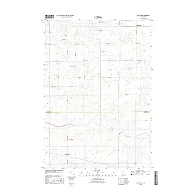
2015 Map of Hatfield NE
USGS Topo · Published 2015About this map
Shortville and Waterbury anchor this 2015 survey of the marshy transition between Clark and Jackson Counties. The landscape is defined by the winding course of the East Fork Black River and its tributaries, including Rock Creek and Mollies Creek, which cut through a region dominated by extensive wetlands and drainage patterns. The presence of the Levis Cemetery and E Clay School Road points to the area's rural history and settled foundations, even as much of the terrain remains undeveloped.
Find a feature on this map
37 named features on this map. Tap any name to fly to it.
Don’t see what you’re looking for? This feature index may not catch every label — zoom into the map to look around manually.
Map Details
Editions of this 2015 Hatfield NE Map
This is the sole edition of this map. No revisions or reprints were ever made.
Other maps of this area

1953 · Neillsville
USGS Topo · 1:62,500

1953 · Eau Claire
USGS Topo · 1:250,000

1954 · Granton
USGS Topo · 1:62,500

1957 · City Point
USGS Topo · 1:48,000

1958 · Eau Claire
USGS Topo · 1:250,000

1958 · Hatfield
USGS Topo · 1:48,000

1964 · Eau Claire
USGS Topo · 1:250,000
1970 · Hatfield SW
USGS Topo · 1:24,000

1970 · Spaulding
USGS Topo · 1:24,000
1970 · Hatfield
USGS Topo · 1:24,000