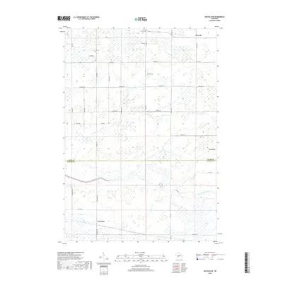
2018 Map of Hatfield NE
USGS Topo · Published 2018About this map
Waterbury and Shortville serve as small rural hubs within this landscape along the border of Clark and Jackson Counties. The terrain is defined by the winding course of the East Fork Black River, which flows through the southern portion of the sheet, supported by tributaries like Rock Creek and Mollies Creek. Local infrastructure is marked by a grid of agricultural and timber roads such as Sherwood Road and Pineview Road, while Brushy Ridge provides a distinct topographic variation to the otherwise level wetlands and woods. Genealogists will find the Levis Cemetery north of Dump Road, a quiet landmark in a region characterized by its dispersed settlement pattern and heavy focus on natural watercourses and drainage.
Find a feature on this map
34 named features on this map. Tap any name to fly to it.
Don’t see what you’re looking for? This feature index may not catch every label — zoom into the map to look around manually.
Map Details
Editions of this 2018 Hatfield NE Map
This is the sole edition of this map. No revisions or reprints were ever made.
Other maps of this area

1953 · Neillsville
USGS Topo · 1:62,500

1953 · Eau Claire
USGS Topo · 1:250,000

1954 · Granton
USGS Topo · 1:62,500

1957 · City Point
USGS Topo · 1:48,000

1958 · Eau Claire
USGS Topo · 1:250,000

1958 · Hatfield
USGS Topo · 1:48,000

1964 · Eau Claire
USGS Topo · 1:250,000
1970 · Hatfield SW
USGS Topo · 1:24,000

1970 · Spaulding
USGS Topo · 1:24,000
1970 · Hatfield
USGS Topo · 1:24,000