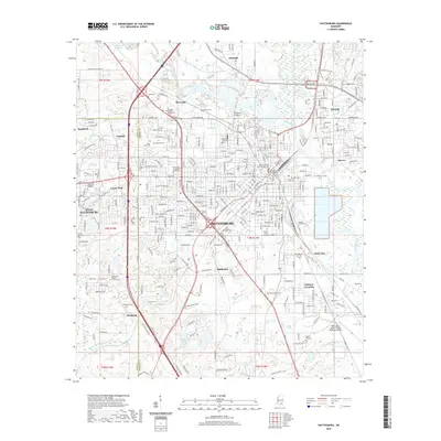
2020 Map of Hattiesburg
USGS Topo · Published 2020About this map
The Leaf River and Bouie River converge in this Mississippi urban landscape, shaping the growth of Hattiesburg and the neighboring community of Petal. Significant educational institutions anchor the area, including the sprawling University of Southern Mississippi and William Carey University. The city's civic center is clearly defined by the Forrest County Courthouse and the Paul B Johnson Chancery Building, while the industrial and logistics corridor follows the KCS Railroad south toward Palmers Crossing.
Find a feature on this map
322 named features on this map. Tap any name to fly to it.
Don’t see what you’re looking for? This feature index may not catch every label — zoom into the map to look around manually.
Map Details
Editions of this 2020 Hattiesburg Map
This is the sole edition of this map. No revisions or reprints were ever made.
Other maps of this area

1947 · New Augusta
USGS Topo · 1:62,500

1949 · New Augusta
USGS Topo · 1:62,500

1953 · Hattiesburg
USGS Topo · 1:250,000

1958 · Hattiesburg
USGS Topo · 1:250,000

1963 · Barrontown
USGS Topo · 1:24,000

1964 · Carterville
USGS Topo · 1:24,000

1964 · Purvis
USGS Topo · 1:24,000

1964 · Hattiesburg
USGS Topo · 1:24,000

1965 · Hattiesburg SW
USGS Topo · 1:24,000

1965 · Dixie
USGS Topo · 1:24,000