
1964 Map of Hattiesburg
USGS Topo · Published 1965About this map
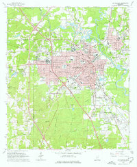
Hattiesburg serves as a major hub for South Mississippi in this mid-century survey, defined by the convergence of several major railroad lines including the Illinois Central, Southern, and Gulf Mobile and Ohio. The city's landscape is shaped by the meeting of the Bowie River and Leaf River to the north, while the expanding campus of the University of Southern Mississippi and William Carey College anchor the educational character of the region. Outside the urban core, smaller communities like Petal, Harvey, and Bonhomie maintain distinct identities, often clustered near the rail lines or industrial operations like the numerous Gravel Pits found near the riverbanks. The detailed plotting of local institutions, from the Methodist Hospital to various family and religious burial grounds like B'nai Israel Cem, provides a thorough record of the area's social and physical infrastructure before modern highway expansions altered the city's outskirts.
Find a feature on this map
84 named features on this map. Tap any name to fly to it.
Don’t see what you’re looking for? This feature index may not catch every label — zoom into the map to look around manually.
Map Details
Editions of this 1964 Hattiesburg Map
4 editions found
Other maps of this area

1947 · New Augusta
USGS Topo · 1:62,500

1949 · New Augusta
USGS Topo · 1:62,500

1953 · Hattiesburg
USGS Topo · 1:250,000

1958 · Hattiesburg
USGS Topo · 1:250,000

1963 · Barrontown
USGS Topo · 1:24,000

1964 · Carterville
USGS Topo · 1:24,000

1964 · Purvis
USGS Topo · 1:24,000

1965 · Hattiesburg SW
USGS Topo · 1:24,000

1965 · Dixie
USGS Topo · 1:24,000

1965 · Eastabuchie
USGS Topo · 1:24,000