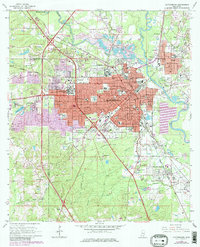
1964 Map of Hattiesburg
USGS Topo · Published 1983About this map
Hattiesburg serves as a significant regional hub where the Bowie River and Leaf River converge. This survey reflects the mid-century expansion of the city and its surrounding communities such as Petal, Glendale, and Palmers Crossing. Educational institutions are prominent, including the University of Southern Mississippi and William Carey College, signaling the area's growth as a center for higher learning. The industrial and transportation landscape is defined by the Illinois Central Gulf railroad, which bisects the urban core and links peripheral settlements like Bonhomie and Dixie Pine. Several cemeteries, such as B'nai Israel Cem and Highland Cem, provide valuable reference points for genealogists tracking local families near the Forrest and Lamar County line. The map also documents the transition from suburban areas like Lamar Park to the outlying Hattiesburg Municipal Airport.
Find a feature on this map
73 named features on this map. Tap any name to fly to it.
Don’t see what you’re looking for? This feature index may not catch every label — zoom into the map to look around manually.
Map Details
Editions of this 1964 Hattiesburg Map
4 editions found
Other maps of this area

1947 · New Augusta
USGS Topo · 1:62,500

1949 · New Augusta
USGS Topo · 1:62,500

1953 · Hattiesburg
USGS Topo · 1:250,000

1958 · Hattiesburg
USGS Topo · 1:250,000

1963 · Barrontown
USGS Topo · 1:24,000

1964 · Carterville
USGS Topo · 1:24,000

1964 · Purvis
USGS Topo · 1:24,000

1964 · Hattiesburg
USGS Topo · 1:24,000

1965 · Hattiesburg SW
USGS Topo · 1:24,000

1965 · Dixie
USGS Topo · 1:24,000