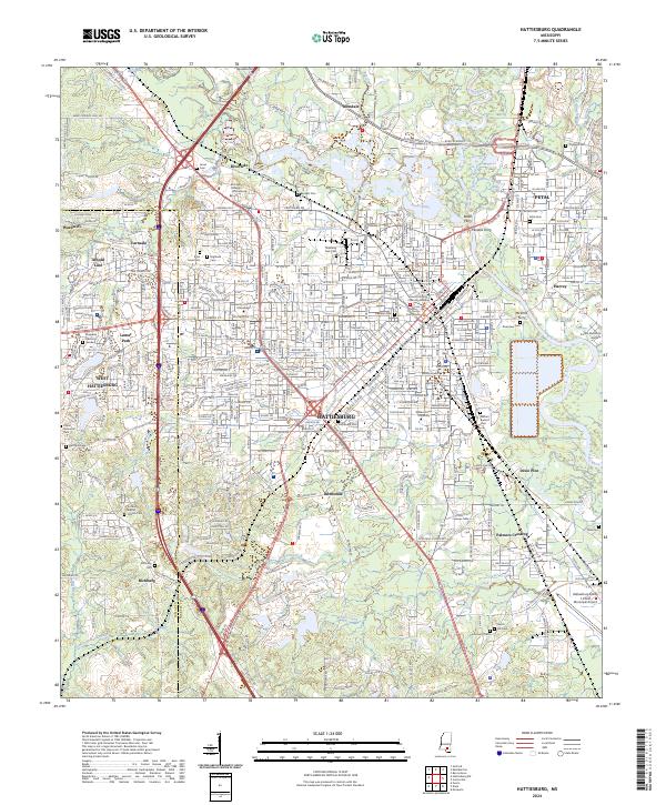
2024 Map of Hattiesburg
USGS Topo · Published 2024About this map
The Bouie River and Leaf River converge in this Mississippi hub, where the Forrest Co and Lamar Co lines divide the urban sprawl. The landscape is defined by its educational and civic institutions, most notably the University of Southern Mississippi and William Carey University, alongside the Forrest County Courthouse. Transport history is visible through a legacy of river crossings like Peoples Ferry, Rawls Ferry, and McInnis Ferry, even as modern corridors like the Evelyn Gandy Pkwy and major lines for Canadian National and Norfolk Southern railroads dominate the modern logistics. Fringing the central city are established residential pockets and historic sites such as Bonhomie, Varnado, and the Hattiesburg Bobby L Chain Municipal Airport. Genealogists will find a dense concentration of burial grounds, including Highland Cem, B'nai Israel Cem, and the Richburg Baptist Church Cem.
Find a feature on this map
80 named features on this map. Tap any name to fly to it.
Don’t see what you’re looking for? This feature index may not catch every label — zoom into the map to look around manually.
Map Details
Editions of this 2024 Hattiesburg Map
This is the sole edition of this map. No revisions or reprints were ever made.
Other maps of this area

1947 · New Augusta
USGS Topo · 1:62,500

1949 · New Augusta
USGS Topo · 1:62,500

1953 · Hattiesburg
USGS Topo · 1:250,000

1958 · Hattiesburg
USGS Topo · 1:250,000

1963 · Barrontown
USGS Topo · 1:24,000

1964 · Carterville
USGS Topo · 1:24,000

1964 · Purvis
USGS Topo · 1:24,000

1964 · Hattiesburg
USGS Topo · 1:24,000

1965 · Hattiesburg SW
USGS Topo · 1:24,000

1965 · Dixie
USGS Topo · 1:24,000