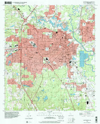
1996 Map of Hattiesburg
USGS Topo · Published 2000About this map
The University of Southern Mississippi and William Carey College anchor this detailed study of the Hub City's mid-90s landscape. The convergence of the Leaf River and Bouie River near Glendale and Riverside highlights the natural hydrologic crossroads that originally established the city. Transportation patterns are defined by the Illinois Central Gulf RR and the Mississippi Central RR, which weave through residential neighborhoods like Lamar Park and industrial zones near the Hattiesburg Municipal Airport.
Find a feature on this map
118 named features on this map. Tap any name to fly to it.
Don’t see what you’re looking for? This feature index may not catch every label — zoom into the map to look around manually.
Map Details
Editions of this 1996 Hattiesburg Map
This is the sole edition of this map. No revisions or reprints were ever made.
Other maps of this area

1947 · New Augusta
USGS Topo · 1:62,500

1949 · New Augusta
USGS Topo · 1:62,500

1953 · Hattiesburg
USGS Topo · 1:250,000

1958 · Hattiesburg
USGS Topo · 1:250,000

1963 · Barrontown
USGS Topo · 1:24,000

1964 · Carterville
USGS Topo · 1:24,000

1964 · Purvis
USGS Topo · 1:24,000

1964 · Hattiesburg
USGS Topo · 1:24,000

1965 · Hattiesburg SW
USGS Topo · 1:24,000

1965 · Dixie
USGS Topo · 1:24,000