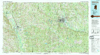
1994 Map of Hattiesburg
USGS Topo · Published 1995About this map
The Leaf River and Pearl River drainage basins define the landscape of south-central Mississippi in the mid-1990s. The city of Hattiesburg serves as a major hub, where the Illinois Central Railroad and Southern Railway intersect amidst a network of federal highways. To the south and east, the massive Camp Shelby Military Reservation dominates the piney woods, bordered by the expansive De Soto National Forest. This era shows a region balancing industrial centers with large-scale conservation and state-managed lands like the Marion County State Wildlife Management Area. Cultural landmarks and small-town history are preserved through labels such as Old Pioneer Cem and the church at Spring Cottage, while the presence of the Columbia Training School near the river reflects the institutional footprint of the time.
Find a feature on this map
62 named features on this map. Tap any name to fly to it.
Don’t see what you’re looking for? This feature index may not catch every label — zoom into the map to look around manually.
Map Details
Editions of this 1994 Hattiesburg Map
This is the sole edition of this map. No revisions or reprints were ever made.
Other maps of this area

1942 · Thomas
USGS Topo · 1:31,680

1947 · Beaumont
USGS Topo · 1:62,500

1947 · Wiggins
USGS Topo · 1:62,500

1947 · New Augusta
USGS Topo · 1:62,500

1947 · Benndale
USGS Topo · 1:62,500

1949 · Wiggins
USGS Topo · 1:62,500

1949 · Beaumont
USGS Topo · 1:62,500

1949 · New Augusta
USGS Topo · 1:62,500

1949 · Benndale
USGS Topo · 1:62,500

1949 · Angie
USGS Topo · 1:31,680