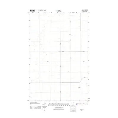
2013 Map of Haug
USGS Topo · Published 2013About this map
Haug and Leo define the primary settlement points in this northern reach of Roseau County, where the landscape is intricately shaped by early 20th-century drainage engineering. The State-Ditch-Number-Seventytwo is a prominent linear feature, illustrating the significant efforts required to manage the hydrology of these flat plains for agricultural use. For those tracing family roots in the area, the map preserves the locations of local burial grounds, including Olland Cem situated along Co Hwy-10 and Bethania Cem further south. A grid of rural roads, such as Co Hwy-7 and Co Hwy-26, provides a clear framework for identifying old homesteads and field patterns in this quiet section of the Minnesota borderlands.
Find a feature on this map
12 named features on this map. Tap any name to fly to it.
Don’t see what you’re looking for? This feature index may not catch every label — zoom into the map to look around manually.
Map Details
Editions of this 2013 Haug Map
This is the sole edition of this map. No revisions or reprints were ever made.
Other maps of this area

1918 · Greenbush
USGS Topo · 1:62,500

1919 · Pelan
USGS Topo · 1:62,500

1919 · Badger
USGS Topo · 1:62,500

1930 · Juneberry
USGS Topo · 1:31,680

1932 · Juneberry
USGS Topo · 1:62,500

1952 · Thief River Falls
USGS Topo · 1:250,000

1956 · Thief River Falls
USGS Topo · 1:250,000

1957 · Thief River Falls
USGS Topo · 1:250,000

1957 · Pelan
USGS Topo · 1:62,500
1962 · Greenbush NE
USGS Topo · 1:24,000