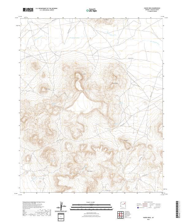
2021 Map of Hauke Mesa
USGS Topo · Published 2021About this map
Hauke Mesa and its surrounding plateau dominate this high-altitude landscape in Navajo County, defined by a network of seasonal washes and isolated buttes. Water management is a primary feature of the terrain, visible through the presence of the Betony Reservoir and several named water sources such as Shanetot Spring and Lukai Spring. These reliable points of hydration have historically dictated movement across the arid land, supporting grazing and travel between the distinctive geological formations of Betony Butte and Horse Butte. Navigation in the region relies on a grid of Bureau of Indian Affairs routes, including Indian Rte 9062, which skirts the base of Cave Mtn. The landscape is etched by the broad Ha-whi-yalin Wash to the north and Lukai Wash to the south, illustrating the drainage patterns of the Colorado Plateau.
Find a feature on this map
27 named features on this map. Tap any name to fly to it.
Don’t see what you’re looking for? This feature index may not catch every label — zoom into the map to look around manually.
Map Details
Editions of this 2021 Hauke Mesa Map
This is the sole edition of this map. No revisions or reprints were ever made.
Other maps of this area

1883 · Tusayan
USGS Topo · 1:250,000

1886 · Tusayan
USGS Topo · 1:250,000

1947 · Flagstaff
USGS Topo · 1:250,000

1954 · Flagstaff
USGS Topo · 1:250,000

1958 · Flagstaff
USGS Topo · 1:250,000

1960 · Flagstaff
USGS Topo · 1:250,000

1962 · Flagstaff
USGS Topo · 1:250,000

1966 · White Cone
USGS Topo · 1:62,500

1966 · Egloffstein Butte
USGS Topo · 1:62,500
1967 · Dilkon
USGS Topo · 1:24,000