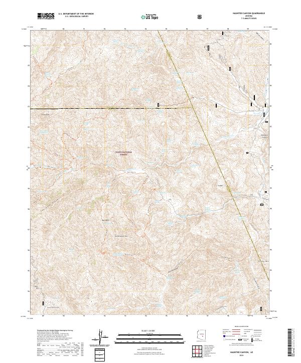
2021 Map of Haunted Canyon
USGS Topo · Published 2021About this map
Tonto National Forest defines the rugged topography of this 2021 survey, where the convergence of Maricopa, Gila, and Pinal counties meets in a landscape of sharp ridges and canyons. The namesake Haunted Canyon and its associated Haunted Canyon Trl wind through the southern half of the quadrangle, passing beneath the heights of J K Mtn and Grizzly Mtn. Water sources are the primary points of interest in this arid terrain, with numerous named springs such as Musk Hog Spring, Bootlegger Spring, and Cane Knife Spring providing essential waypoints for travelers.
Find a feature on this map
109 named features on this map. Tap any name to fly to it.
Don’t see what you’re looking for? This feature index may not catch every label — zoom into the map to look around manually.
Map Details
Editions of this 2021 Haunted Canyon Map
This is the sole edition of this map. No revisions or reprints were ever made.
Other maps of this area

1900 · Florence
USGS Topo · 1:125,000

1901 · Globe
USGS Topo · 1:62,500

1902 · Globe
USGS Topo · 1:62,500

1902 · Florence
USGS Topo · 1:125,000

1907 · Roosevelt
USGS Topo · 1:125,000

1909 · Four Peaks
USGS Topo · 1:125,000

1912 · Roosevelt
USGS Topo · 1:125,000

1922 · Chrysotile
USGS Topo · 1:125,000

1945 · Inspiration
USGS Topo · 1:24,000

1947 · Inspiration
USGS Topo · 1:24,000