1977 Map of Hauula
USGS Topo · Published 1984About this map
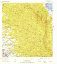
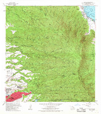
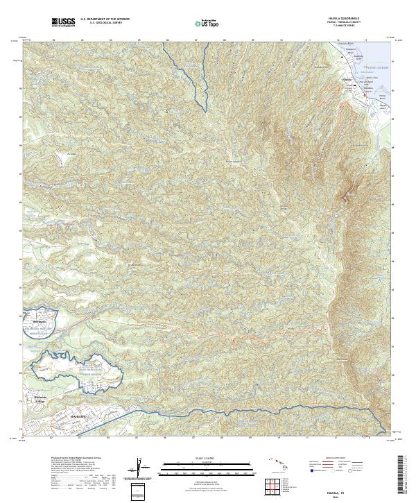
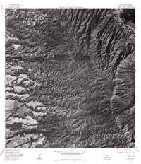
Hauula sits on the windward coast of Oahu, shown here in an orthophotomap produced from 1977 aerial photography. This perspective reveals the dramatic transition from the coastal settlement near the Pacific into the deep, fluted valleys of the interior mountains. The terrain is dominated by steep ridges and the path of Kaluanui Stream, which cuts through the volcanic landscape. To the southwest, the town of Wahiawa marks a shift toward more level ground and residential development, contrasting sharply with the undeveloped slopes of the central range. On the southern edge of the survey, the Ku Tree Res represents the essential water management infrastructure required for the island's interior. This 1970s record provides a clear view of the interface between urban expansion and the island's natural watershed boundaries.
Find a feature on this map
4 named features on this map. Tap any name to fly to it.
Don’t see what you’re looking for? This feature index may not catch every label — zoom into the map to look around manually.
Map Details
Editions of this 1977 Hauula Map
This is the sole edition of this map. No revisions or reprints were ever made.
Historical Maps of Wahiawā Through Time
8 maps found