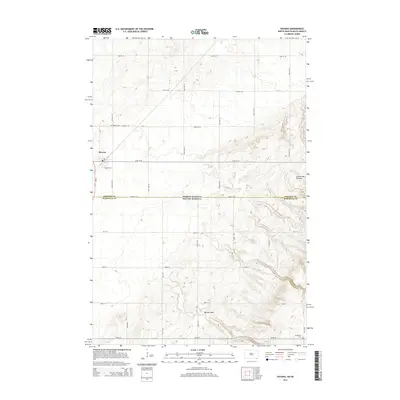
2014 Map of Havana
USGS Topo · Published 2014About this map
Havana sits near the northern edge of the Coteau des Prairies, a prominent upland plateau that rises sharply above the surrounding plains. This 2014 survey documents the agricultural grid of Sargent County, North Dakota, where it meets the Marshall County border at the South Dakota state line. The township’s layout is defined by section roads like 98th St SE and 133rd Ave SE, reflecting a landscape dedicated to large-scale farming. Significant local history markers include the Havana Cem and Trondhjem Cem, which serve as quiet anchors for the region’s ancestral heritage. To the south, the topography grows more complex as the land descends into Marble Gulch, illustrating the transition from the high prairie plateau to the carved drainage systems that break the flat horizon of the Dakotas.
Find a feature on this map
30 named features on this map. Tap any name to fly to it.
Don’t see what you’re looking for? This feature index may not catch every label — zoom into the map to look around manually.
Map Details
Editions of this 2014 Havana Map
This is the sole edition of this map. No revisions or reprints were ever made.
Other maps of this area

1907 · Wyndmere
USGS Topo · 1:125,000

1953 · Britton East
USGS Topo · 1:24,000

1953 · Kidder
USGS Topo · 1:24,000

1953 · Milbank
USGS Topo · 1:250,000

1953 · Fargo
USGS Topo · 1:250,000

1954 · Kidder SE
USGS Topo · 1:24,000

1956 · Fargo
USGS Topo · 1:250,000

1956 · Havana
USGS Topo · 1:24,000

1958 · Milbank
USGS Topo · 1:250,000

1958 · Hillhead
USGS Topo · 1:24,000