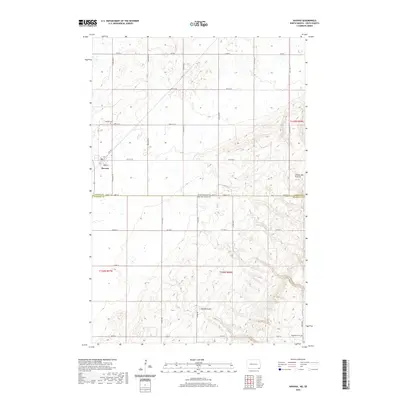
2020 Map of Havana
USGS Topo · Published 2020About this map
Havana sits at the intersection of a vast agricultural landscape and the rising elevation of the Coteau des Prairies in this survey. The terrain transitions from the relatively flat township sections of Sargent County, North Dakota, into the more undulating contours of Marshall County, South Dakota. This boundary is marked by a shift in the road naming convention at 100th St, where the grid system adjusts to the state line. Genealogists will find the locations of Havana Cem just north of the settlement and Trondhjem Cem in the southeastern portion of the map, near the end of 104th St. The natural drainage of the area is defined by Marble Gulch, which cuts through the southern hills, contrasting with the engineered precision of the section lines and county roads like Co Hwy 2.
Find a feature on this map
32 named features on this map. Tap any name to fly to it.
Don’t see what you’re looking for? This feature index may not catch every label — zoom into the map to look around manually.
Map Details
Editions of this 2020 Havana Map
This is the sole edition of this map. No revisions or reprints were ever made.
Other maps of this area

1907 · Wyndmere
USGS Topo · 1:125,000

1953 · Britton East
USGS Topo · 1:24,000

1953 · Kidder
USGS Topo · 1:24,000

1953 · Milbank
USGS Topo · 1:250,000

1953 · Fargo
USGS Topo · 1:250,000

1954 · Kidder SE
USGS Topo · 1:24,000

1956 · Fargo
USGS Topo · 1:250,000

1956 · Havana
USGS Topo · 1:24,000

1958 · Milbank
USGS Topo · 1:250,000

1958 · Hillhead
USGS Topo · 1:24,000