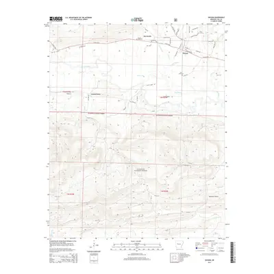
2014 Map of Havana
USGS Topo · Published 2014About this map
The Petit Jean River winds through the northern half of this landscape, separating the agricultural valley floors of Havana and Marvinville from the rising elevations of the Ouachita National Forest. This 2014 survey documents a region defined by its rural heritage, where family and community roots are firmly anchored by numerous burial sites such as the Havana Cemetery, Pleasant Valley Cem, and the Davis Family Cem. To the south, the terrain becomes increasingly complex as the forest covers ridges drained by Mill Cr and Moss Cr. Transportation follows the valley contours, with W AR 10 Hwy and N AR 309 Hwy serving as the primary arteries for these communities. The map provides a clear record of local geography, from the quiet settlement of Walnut Grove to the distinct drainage of Blackman Hollow, illustrating the balance between managed forest lands and private homesteads.
Find a feature on this map
54 named features on this map. Tap any name to fly to it.
Don’t see what you’re looking for? This feature index may not catch every label — zoom into the map to look around manually.
Map Details
Editions of this 2014 Havana Map
This is the sole edition of this map. No revisions or reprints were ever made.
Other maps of this area

1879 · Mountain Home
USGS Topo · 1:62,500

1887 · Magazine Mountain #4
USGS Topo · 1:62,500

1887 · Magazine Mountain
USGS Topo · 1:62,500

1888 · Dardanelle #3
USGS Topo · 1:62,500

1890 · Magazine Mountain
USGS Topo · 1:125,000

1890 · Mount Ida
USGS Topo · 1:125,000

1890 · Hot Springs
USGS Topo · 1:125,000

1890 · Dardanelle
USGS Topo · 1:125,000

1894 · Hot Springs
USGS Topo · 1:125,000

1955 · Little Rock
USGS Topo · 1:250,000