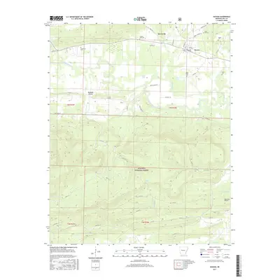
2017 Map of Havana
USGS Topo · Published 2017About this map
Havana serves as the primary hub in this portion of Yell County, situated north of the expansive Ouachita National Forest. The landscape is defined by the winding course of the Petit Jean River, which draws in numerous tributaries such as Little Piney Cr and Truett Cr. The local settlement pattern is anchored by several long-established communities, including Marvinville and Walnut Grove, connected by a network of county roads like Walnut Grove Rd and Jack Creek Rd. For those researching local families, the map is particularly detailed regarding burial sites, identifying the Piney Fork Cem, Pleasant Valley Cem, and the Davis Family Cem. The southern half of the quadrangle transitions into the protected timberlands of the national forest, where the terrain becomes more complex around Blackman Hollow and the headwaters of Moss Cr.
Find a feature on this map
62 named features on this map. Tap any name to fly to it.
Don’t see what you’re looking for? This feature index may not catch every label — zoom into the map to look around manually.
Map Details
Editions of this 2017 Havana Map
This is the sole edition of this map. No revisions or reprints were ever made.
Other maps of this area

1879 · Mountain Home
USGS Topo · 1:62,500

1887 · Magazine Mountain #4
USGS Topo · 1:62,500

1887 · Magazine Mountain
USGS Topo · 1:62,500

1888 · Dardanelle #3
USGS Topo · 1:62,500

1890 · Magazine Mountain
USGS Topo · 1:125,000

1890 · Mount Ida
USGS Topo · 1:125,000

1890 · Hot Springs
USGS Topo · 1:125,000

1890 · Dardanelle
USGS Topo · 1:125,000

1894 · Hot Springs
USGS Topo · 1:125,000

1955 · Little Rock
USGS Topo · 1:250,000