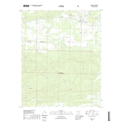
2020 Map of Havana
USGS Topo · Published 2020About this map
Havana and its surrounding Yell County landscape are defined by the winding course of the Petit Jean River, which meanders through the northern half of this 2020 topographic survey. The township of Havana is a clear focal point, showing a structured grid of streets including E Broadway, Mitchell St, and Green St. To the west, the settlement of Walnut Grove and the crossroads of Marvinville mark the transition toward the more elevation-heavy southern terrain. This lower half of the map is dominated by the dense canopy of the Ouachita National Forest, where the terrain rises sharply from the river valley into a network of drainages including Mill Cr and Riley Cr. Genealogists will find a high concentration of burial sites throughout the rural areas, such as Underwood Cem near the river and the Davis Family Cem further east, reflecting the deep-rooted family history of this Arkansas river valley.
Find a feature on this map
61 named features on this map. Tap any name to fly to it.
Don’t see what you’re looking for? This feature index may not catch every label — zoom into the map to look around manually.
Map Details
Editions of this 2020 Havana Map
This is the sole edition of this map. No revisions or reprints were ever made.
Other maps of this area

1879 · Mountain Home
USGS Topo · 1:62,500

1887 · Magazine Mountain #4
USGS Topo · 1:62,500

1887 · Magazine Mountain
USGS Topo · 1:62,500

1888 · Dardanelle #3
USGS Topo · 1:62,500

1890 · Magazine Mountain
USGS Topo · 1:125,000

1890 · Mount Ida
USGS Topo · 1:125,000

1890 · Hot Springs
USGS Topo · 1:125,000

1890 · Dardanelle
USGS Topo · 1:125,000

1894 · Hot Springs
USGS Topo · 1:125,000

1955 · Little Rock
USGS Topo · 1:250,000