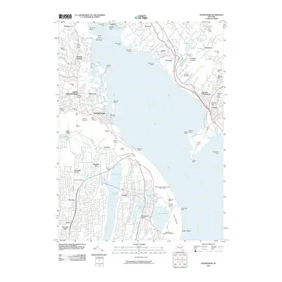
2010 Map of Haverstraw
USGS Topo · Published 2010About this map
Stony Point Light House stands as a sentinel over the Hudson River on this 2010 survey, marking a stretch of water where narrow channels and prominent headlands like Verplanck Point and Stony Point have long dictated river navigation. The landscape is defined by the sharp transition from the water's edge to the high elevations of High Tor and Hook Mountain, which hem in the dense residential growth of Haverstraw and West Haverstraw.
Find a feature on this map
95 named features on this map. Tap any name to fly to it.
Don’t see what you’re looking for? This feature index may not catch every label — zoom into the map to look around manually.
Map Details
Editions of this 2010 Haverstraw Map
This is the sole edition of this map. No revisions or reprints were ever made.
Other maps of this area

1891 · Ramapo
USGS Topo · 1:62,500

1892 · West Point
USGS Topo · 1:62,500

1892 · Tarrytown
USGS Topo · 1:62,500

1893 · Tarrytown
USGS Topo · 1:62,500

1893 · Ramapo
USGS Topo · 1:62,500

1894 · West Point
USGS Topo · 1:62,500

1899 · West Point
USGS Topo · 1:62,500

1901 · West Point
USGS Topo · 1:62,500

1902 · Tarrytown
USGS Topo · 1:62,500

1902 · Schunemunk
USGS Topo · 1:62,500