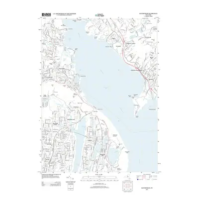
2013 Map of Haverstraw
USGS Topo · Published 2013About this map
Haverstraw Bay dominates this view of the lower Hudson Valley, where the river widens significantly between the western cliffs and the eastern peninsulas. The historic Stony Point Light House guards the narrow passage north of the bay, marking a landscape defined by significant elevation changes from the water's edge to peaks like High Tor and South Mountain. On the western shore, the residential patterns of New City, Congers, and Garnerville show the modern suburban character of Rockland County, while the eastern shore is marked by the distinct village of Croton-on-Hudson.
Find a feature on this map
74 named features on this map. Tap any name to fly to it.
Don’t see what you’re looking for? This feature index may not catch every label — zoom into the map to look around manually.
Map Details
Editions of this 2013 Haverstraw Map
This is the sole edition of this map. No revisions or reprints were ever made.
Other maps of this area

1891 · Ramapo
USGS Topo · 1:62,500

1892 · West Point
USGS Topo · 1:62,500

1892 · Tarrytown
USGS Topo · 1:62,500

1893 · Tarrytown
USGS Topo · 1:62,500

1893 · Ramapo
USGS Topo · 1:62,500

1894 · West Point
USGS Topo · 1:62,500

1899 · West Point
USGS Topo · 1:62,500

1901 · West Point
USGS Topo · 1:62,500

1902 · Tarrytown
USGS Topo · 1:62,500

1902 · Schunemunk
USGS Topo · 1:62,500