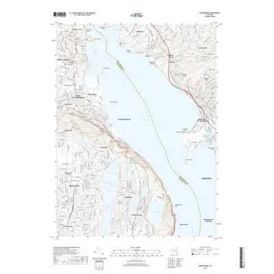
2019 Map of Haverstraw
USGS Topo · Published 2019About this map
Haverstraw and Croton-On-Hudson face one another across the wide expanse of Haverstraw Bay, where the Hudson River widens between Westchester and Rockland Counties. The shoreline on both sides is defined by prominent geographical landmarks like Croton Point, Verplanck Point, and the steep rise of High Tor and Hook Mtn. Inland to the west, the landscape is densely settled, anchored by the Rockland County Courthouse in New City and a series of historical burial grounds including Saint Peters Cem and Mount Repose Cem.
Find a feature on this map
73 named features on this map. Tap any name to fly to it.
Don’t see what you’re looking for? This feature index may not catch every label — zoom into the map to look around manually.
Map Details
Editions of this 2019 Haverstraw Map
This is the sole edition of this map. No revisions or reprints were ever made.
Other maps of this area

1891 · Ramapo
USGS Topo · 1:62,500

1892 · West Point
USGS Topo · 1:62,500

1892 · Tarrytown
USGS Topo · 1:62,500

1893 · Tarrytown
USGS Topo · 1:62,500

1893 · Ramapo
USGS Topo · 1:62,500

1894 · West Point
USGS Topo · 1:62,500

1899 · West Point
USGS Topo · 1:62,500

1901 · West Point
USGS Topo · 1:62,500

1902 · Tarrytown
USGS Topo · 1:62,500

1902 · Schunemunk
USGS Topo · 1:62,500