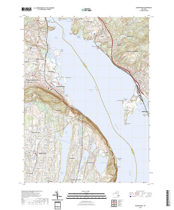
2023 Map of Haverstraw
USGS Topo · Published 2023About this map
The Hudson River dominates this landscape, where the widening Haverstraw Bay separates the riverfront settlements of Rockland and Westchester counties. Along the western shore, the dense street grids of Haverstraw and West Haverstraw are constrained by the rising elevations of High Tor and South Mountain. This geography forced development into a corridor between the river and the highlands, as seen in the placement of the Mount Repose Cem and the Conrail lines that trace the waterfront.
Find a feature on this map
74 named features on this map. Tap any name to fly to it.
Don’t see what you’re looking for? This feature index may not catch every label — zoom into the map to look around manually.
Map Details
Editions of this 2023 Haverstraw Map
This is the sole edition of this map. No revisions or reprints were ever made.
Other maps of this area

1891 · Ramapo
USGS Topo · 1:62,500

1892 · West Point
USGS Topo · 1:62,500

1892 · Tarrytown
USGS Topo · 1:62,500

1893 · Tarrytown
USGS Topo · 1:62,500

1893 · Ramapo
USGS Topo · 1:62,500

1894 · West Point
USGS Topo · 1:62,500

1899 · West Point
USGS Topo · 1:62,500

1901 · West Point
USGS Topo · 1:62,500

1902 · Tarrytown
USGS Topo · 1:62,500

1902 · Schunemunk
USGS Topo · 1:62,500