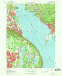
1967 Map of Haverstraw
USGS Topo · Published 1969About this map
High Tor State Park and the massive ridge of Verdrietege Hook Mountain dominate the western shoreline of the Hudson River, marking a dramatic topographical transition in the late 1960s. The riverside settlements of Haverstraw, West Haverstraw, and Stony Point show a dense mid-century residential and institutional fabric, including the State Rehabilitation Hospital and several parochial schools like St Peters Sch. Across the wide expanse of Haverstraw Bay, the map details the industrial and institutional complex at Montrose and the extensive grounds of the Franklin D Roosevelt VA Hospital. To the south, the suburban expansion around New City is clearly visible, with residential grids pressing against the shores of De Forest Lake and Rockland Lake. This survey captures the region just as the Palisades Interstate Pkwy was firmly established as the primary corridor, contrasting with the older rail lines of the Penn Central following the river's edge.
Find a feature on this map
90 named features on this map. Tap any name to fly to it.
Don’t see what you’re looking for? This feature index may not catch every label — zoom into the map to look around manually.
Map Details
Editions of this 1967 Haverstraw Map
This is the sole edition of this map. No revisions or reprints were ever made.
Other maps of this area

1891 · Ramapo
USGS Topo · 1:62,500

1892 · West Point
USGS Topo · 1:62,500

1892 · Tarrytown
USGS Topo · 1:62,500

1893 · Tarrytown
USGS Topo · 1:62,500

1893 · Ramapo
USGS Topo · 1:62,500

1894 · West Point
USGS Topo · 1:62,500

1899 · West Point
USGS Topo · 1:62,500

1901 · West Point
USGS Topo · 1:62,500

1902 · Tarrytown
USGS Topo · 1:62,500

1902 · Schunemunk
USGS Topo · 1:62,500