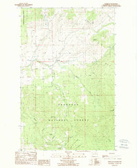
1988 Map of Havillah
USGS Topo · Published 1988About this map
Havillah and the surrounding high country of the Okanogan National Forest are defined by sharp elevation shifts and a network of mountain drainages in this 1980s survey. The landscape transitions from the relatively open Eden Valley in the north toward the prominent peaks of Bimetalic Mountain and Mt Bonaparte. Evidence of local industry and community infrastructure appears through the several Gravel Pits and the local Cem, while a Roadside Park along Antoine Creek suggests the area's role as a transit corridor through the northern Cascades. The map detail highlights the convergence of Mill Creek and smaller seasonal Springs, tracing the rugged topography from Knob Hill down to the southern extent of Fourth of July Ridge.
Find a feature on this map
21 named features on this map. Tap any name to fly to it.
Don’t see what you’re looking for? This feature index may not catch every label — zoom into the map to look around manually.
Map Details
Editions of this 1988 Havillah Map
This is the sole edition of this map. No revisions or reprints were ever made.
Other maps of this area

1902 · Osoyoos
USGS Topo · 1:125,000

1904 · Osoyoos
USGS Topo · 1:125,000

1954 · Okanogan
USGS Topo · 1:250,000

1957 · Mt. Bonaparte
USGS Topo · 1:62,500

1957 · Tonasket
USGS Topo · 1:62,500

1957 · Oroville
USGS Topo · 1:62,500

1957 · Aeneas Valley
USGS Topo · 1:62,500

1958 · Okanogan
USGS Topo · 1:250,000
1981 · Barker Mtn
USGS Topo · 1:24,000
1981 · Burge Mtn
USGS Topo · 1:24,000