
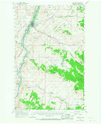
1957 Map of Tonasket
USGS Topo · Published 1958About this map
The Okanogan River corridor defines this mid-century landscape, serving as the primary artery for transport and settlement. Along its banks, the Great Northern railroad tracks connect the town of Tonasket to smaller points like Janis and Barker. This era of the late 1950s shows a valley deeply tied to its geography, where the river's path is marked by features like McLoughlin Falls and McAllister Rapids.
Find a feature on this map
48 named features on this map. Tap any name to fly to it.
Don’t see what you’re looking for? This feature index may not catch every label — zoom into the map to look around manually.
Map Details
Editions of this 1957 Tonasket Map
2 editions found
Other maps of this area

1902 · Osoyoos
USGS Topo · 1:125,000

1904 · Osoyoos
USGS Topo · 1:125,000

1905 · Okanogan
USGS Topo · 1:125,000

1906 · Chopaka
USGS Topo · 1:125,000

1952 · Disautel
USGS Topo · 1:62,500

1953 · Omak Lake
USGS Topo · 1:62,500

1954 · Okanogan
USGS Topo · 1:250,000

1956 · Loomis
USGS Topo · 1:62,500

1957 · Okanogan
USGS Topo · 1:62,500

1957 · Conconully
USGS Topo · 1:62,500