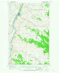
1957 Map of Tonasket
USGS Topo · Published 1968About this map
The Okanogan River defines the western valley of this mid-century survey, serving as the primary corridor for both the Great Northern railroad and the town of Tonasket. In the 1950s, this area functioned as a hub for local infrastructure, featuring a High Sch, a Filtration Plant, and a Substation. Away from the river, the landscape rises into the Okanogan Natl Forest, where small settlements like Synarep and Anglin are connected by winding mountain roads.
Find a feature on this map
42 named features on this map. Tap any name to fly to it.
Don’t see what you’re looking for? This feature index may not catch every label — zoom into the map to look around manually.
Map Details
Editions of this 1957 Tonasket Map
2 editions found

Other maps of this area

1902 · Osoyoos
USGS Topo · 1:125,000

1904 · Osoyoos
USGS Topo · 1:125,000

1905 · Okanogan
USGS Topo · 1:125,000

1906 · Chopaka
USGS Topo · 1:125,000

1952 · Disautel
USGS Topo · 1:62,500

1953 · Omak Lake
USGS Topo · 1:62,500

1954 · Okanogan
USGS Topo · 1:250,000

1956 · Loomis
USGS Topo · 1:62,500

1957 · Okanogan
USGS Topo · 1:62,500

1957 · Conconully
USGS Topo · 1:62,500