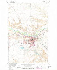
1964 Map of Havre
USGS Topo · Published 1978About this map
Havre serves as the focal point of this mid-century landscape, positioned where the Great Northern railroad tracks parallel the winding course of the Milk River. The town's institutional growth is evident through numerous educational sites, including Northern Montana College, Central High Sch, and several neighborhood schools like Highland Park Sch and Lincoln-McKinley Sch. The mapping detail extends to the surrounding prairie, showing a network of coulees and creeks such as Beaver Creek and Bullhook Creek feeding into the valley.
Find a feature on this map
41 named features on this map. Tap any name to fly to it.
Don’t see what you’re looking for? This feature index may not catch every label — zoom into the map to look around manually.
Map Details
Editions of this 1964 Havre Map
2 editions found

Other maps of this area

1904 · Havre
USGS Topo · 1:62,500

1904 · Assinniboine
USGS Topo · 1:62,500

1912 · Thibedeau Lake
USGS Topo · 1:125,000

1953 · Havre
USGS Topo · 1:250,000

1957 · Havre
USGS Topo · 1:250,000

1958 · Havre
USGS Topo · 1:250,000

1959 · Laredo
USGS Topo · 1:62,500

1959 · Shambo
USGS Topo · 1:62,500

1964 · Havre NW
USGS Topo · 1:24,000

1964 · Havre SE
USGS Topo · 1:24,000
Featured Places
- Havre, MT
- Pats Trailer Park, MT
- Bitterroot Trailer Court, MT
- Shennum Trailer Court, MT
- Thiels West Trailer Court, MT