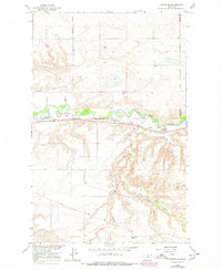
1964 Map of Havre SE
USGS Topo · Published 1978About this map
The Milk River carves a sinuous path through this section of the northern Montana plains, defining the topography south of Shepherd Road. This area, situated along the county line between Hill and Blaine Counties, shows a landscape shaped by both natural drainage and early twentieth-century infrastructure. The presence of the Great Northern rail line running parallel to the river highlights the importance of the corridor for transportation and freight during this era.
Find a feature on this map
19 named features on this map. Tap any name to fly to it.
Don’t see what you’re looking for? This feature index may not catch every label — zoom into the map to look around manually.
Map Details
Editions of this 1964 Havre SE Map
2 editions found

Other maps of this area

1904 · Yantic
USGS Topo · 1:62,500

1904 · Havre
USGS Topo · 1:62,500

1912 · Zurich
USGS Topo · 1:125,000

1912 · Thibedeau Lake
USGS Topo · 1:125,000

1953 · Havre
USGS Topo · 1:250,000

1956 · Lloyd
USGS Topo · 1:62,500

1957 · Havre
USGS Topo · 1:250,000

1958 · Havre
USGS Topo · 1:250,000

1959 · Shambo
USGS Topo · 1:62,500

1964 · Havre NW
USGS Topo · 1:24,000