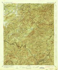
1937 Map of Haw Knob
USGS Topo · Published 1937About this map
Tellico Plains serves as the western gateway to this high-country landscape, where the Tellico River winds through the deep valleys of the Cherokee National Forest. This 1930s-era survey reveals a mountain economy transitioning from isolated rural settlements to managed forest lands, marked by fire towers like the Waucheesi Lookout and Hemlock Knob Lookout. While the rugged eastern terrain is defined by high peaks such as Haw Knob and Big Junction, the lower elevations near the Tennessee-North Carolina border are dotted with community hubs like New Providence Church and Glendale School. Local history is preserved in the location of remote structures like Whigg Cabin and early family-named landmarks such as McNabb Ridge and Kitchens School. The map records the intricate network of watercourses, including Bald River and Citico Creek, that shaped the travel and settlement patterns of Monroe County before the expansion of modern infrastructure.
Find a feature on this map
96 named features on this map. Tap any name to fly to it.
Don’t see what you’re looking for? This feature index may not catch every label — zoom into the map to look around manually.
Map Details
Editions of this 1937 Haw Knob Map
This is the sole edition of this map. No revisions or reprints were ever made.
Other maps of this area

1886 · Knoxville
USGS Topo · 1:125,000

1892 · Knoxville
USGS Topo · 1:125,000

1893 · Murphy
USGS Topo · 1:125,000

1894 · Knoxville
USGS Topo · 1:125,000

1895 · Loudon
USGS Topo · 1:125,000

1895 · Knoxville
USGS Topo · 1:125,000

1901 · Knoxville
USGS Topo · 1:125,000

1914 · Murphy
USGS Topo · 1:125,000

1927 · Big Junction
USGS Topo · 1:24,000

1933 · Haw Knob
USGS Topo · 1:48,000