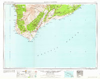
1962 Map of Hawaii South
USGS Topo · Published 1962About this map
Mauna Loa dominates the interior of this survey, revealing the rugged volcanic geography of southern Hawaii during the early 1960s. The map traces the intricate network of forest reserves, including the Honaunau Forest Reserve and Kapua-Manuka Forest Reserve, which stretch from the coastline toward the higher elevations. Settlement patterns are concentrated along the coast and volcanic slopes, with notable clusters at Captain Cook, Honaunau, and Naalehu.
Find a feature on this map
101 named features on this map. Tap any name to fly to it.
Don’t see what you’re looking for? This feature index may not catch every label — zoom into the map to look around manually.
Map Details
Editions of this 1962 Hawaii South Map
2 editions found

Other maps of this area

1917 · Hilo
USGS Topo · 1:62,500

1921 · Kilauea
USGS Topo · 1:62,500

1922 · Puna
USGS Topo · 1:62,500

1923 · Pahala
USGS Topo · 1:62,500

1924 · Makuu
USGS Topo · 1:62,500

1924 · Kalae
USGS Topo · 1:62,500

1924 · Kilauea
USGS Topo · 1:62,500

1924 · Puna
USGS Topo · 1:62,500

1924 · Kalapana
USGS Topo · 1:62,500

1924 · Honuapo
USGS Topo · 1:62,500