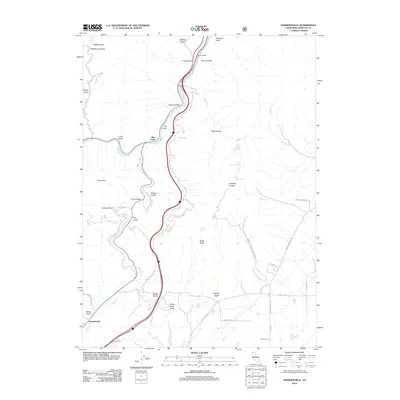
2012 Map of Hawkinsville
USGS Topo · Published 2012About this map
The Klamath River flows through this Northern California landscape, winding through a series of steep drainages including Printer Gulch and Sharps Gulch near the community of Jims Camp. The terrain is defined by its verticality and water resources, marked by landmarks like Paradise Craggy and White Rock, along with numerous water sources such as Iron Trough Spring and Silvas Spring. In the southwest, the settlement of Hawkinsville is situated along Yreka Cr near the convergence of the Shasta River.
Find a feature on this map
54 named features on this map. Tap any name to fly to it.
Don’t see what you’re looking for? This feature index may not catch every label — zoom into the map to look around manually.
Map Details
Editions of this 2012 Hawkinsville Map
This is the sole edition of this map. No revisions or reprints were ever made.
Other maps of this area

1886 · Shasta
USGS Topo · 1:250,000

1894 · Shasta
USGS Topo · 1:250,000

1922 · Shasta Valley Sheet No 4
USGS Topo · 1:24,000

1922 · Shasta Valley Sheet No 3
USGS Topo · 1:24,000

1922 · Shasta Valley Sheet No 14
USGS Topo · 1:24,000

1922 · Shasta Valley Sheet No 5
USGS Topo · 1:24,000

1932 · Yreka
USGS Topo · 1:96,000

1934 · Macdoel
USGS Topo · 1:96,000

1939 · Yreka
USGS Topo · 1:125,000

1941 · Macdoel
USGS Topo · 1:125,000