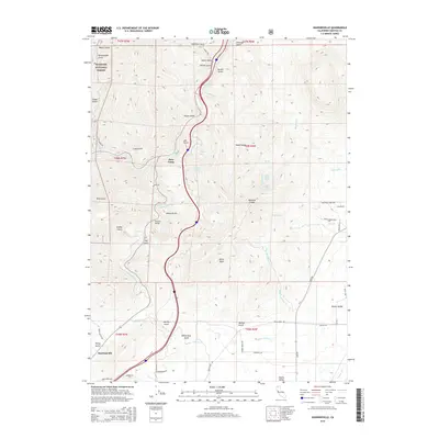
2015 Map of Hawkinsville
USGS Topo · Published 2015About this map
Hawkinsville and the surrounding high country of Siskiyou County are defined by the winding course of the Shasta River and the rugged reaches of the Klamath National Forest. This 2015 study traces the complex network of mountain drainages, from Williams Cr to Maxwell Cr, that flow toward the river valley. The landscape is marked by numerous named ravines such as Jail Gulch, Dutch Gulch, and Rattlesnake Gulch, reflecting the region's topographical complexity and historical land use. Significant landmarks include the Pioneer Bridge and the geological prominence of White Rock. Settlement patterns are concentrated near the river and the northern edge of the Shasta Valley, where local roads like Ager Rd and Yreka Ager Rd connect small clusters like Riverview and Jims Camp. The map also captures several natural springs, including Silvas Spring and Lower Maple Spring, which have long served as vital water sources in this dry, upland environment.
Find a feature on this map
67 named features on this map. Tap any name to fly to it.
Don’t see what you’re looking for? This feature index may not catch every label — zoom into the map to look around manually.
Map Details
Editions of this 2015 Hawkinsville Map
This is the sole edition of this map. No revisions or reprints were ever made.
Other maps of this area

1886 · Shasta
USGS Topo · 1:250,000

1894 · Shasta
USGS Topo · 1:250,000

1922 · Shasta Valley Sheet No 4
USGS Topo · 1:24,000

1922 · Shasta Valley Sheet No 3
USGS Topo · 1:24,000

1922 · Shasta Valley Sheet No 14
USGS Topo · 1:24,000

1922 · Shasta Valley Sheet No 5
USGS Topo · 1:24,000

1932 · Yreka
USGS Topo · 1:96,000

1934 · Macdoel
USGS Topo · 1:96,000

1939 · Yreka
USGS Topo · 1:125,000

1941 · Macdoel
USGS Topo · 1:125,000