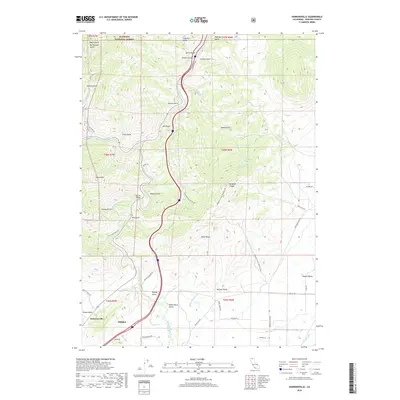
2018 Map of Hawkinsville
USGS Topo · Published 2018About this map
The Klamath River and Shasta River converge in this northern California landscape, which is defined by the steep canyons and narrow gulches surrounding Yreka. The northern edge of the city and the small community of Hawkinsville occupy the valley floor before the terrain rises sharply into the Klamath National Forest. This modern survey illustrates the complex drainage network of the region, including Yreka Cr, Oregon Slu, and numerous named gulches like Jail Gulch and Modoc Gulch.
Find a feature on this map
68 named features on this map. Tap any name to fly to it.
Don’t see what you’re looking for? This feature index may not catch every label — zoom into the map to look around manually.
Map Details
Editions of this 2018 Hawkinsville Map
This is the sole edition of this map. No revisions or reprints were ever made.
Other maps of this area

1886 · Shasta
USGS Topo · 1:250,000

1894 · Shasta
USGS Topo · 1:250,000

1922 · Shasta Valley Sheet No 4
USGS Topo · 1:24,000

1922 · Shasta Valley Sheet No 3
USGS Topo · 1:24,000

1922 · Shasta Valley Sheet No 14
USGS Topo · 1:24,000

1922 · Shasta Valley Sheet No 5
USGS Topo · 1:24,000

1932 · Yreka
USGS Topo · 1:96,000

1934 · Macdoel
USGS Topo · 1:96,000

1939 · Yreka
USGS Topo · 1:125,000

1941 · Macdoel
USGS Topo · 1:125,000